Android App helps to find the next Summit Reference up to 100km

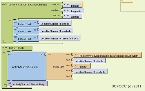
Well, I played today a little bit around with the App Inventor for Android. My idea: the Android device receives the GPS position and passes the coordinates to a web application connected to my summit database. This application lists all summits up to 100km. Programming with the App Inventor is like a mixture of visual programming and puzzeling. Very funny.
Here you have an example of the display, you will get on your Android mobile if you are in Hannover, Germany
The very rudimental App (but it works!) can you download here: www.AdventureRadio.de/apk/NextSota.apk
Or use the QR-Code:

